Seville topographic map
You can find on this page the Seville topographic map to print and to download in PDF. The Seville elevation map present the topography, river and relief of Seville in Spain.
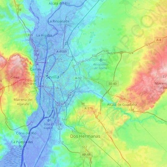
Seville elevation map
The Seville topographic map shows elevation, hills and landforms in Seville. This elevation map of Seville will allow you to know topography, river and relief of Seville in Spain. The Seville topographic map is downloadable in PDF, printable and free.
Seville has an area of 141 km2 (54 sq mi), according to the National Topographic Map (Mapa Topográfico Nacional) series from the Instituto Geográfico Nacional – Centro Nacional de Información Geográfica, the country civilian survey organisation. Seville is situated in the fertile valley of the River Guadalquivir. The average elevation height above sea level is 7 metres (23 feet) as you can see in Seville elevation map.