

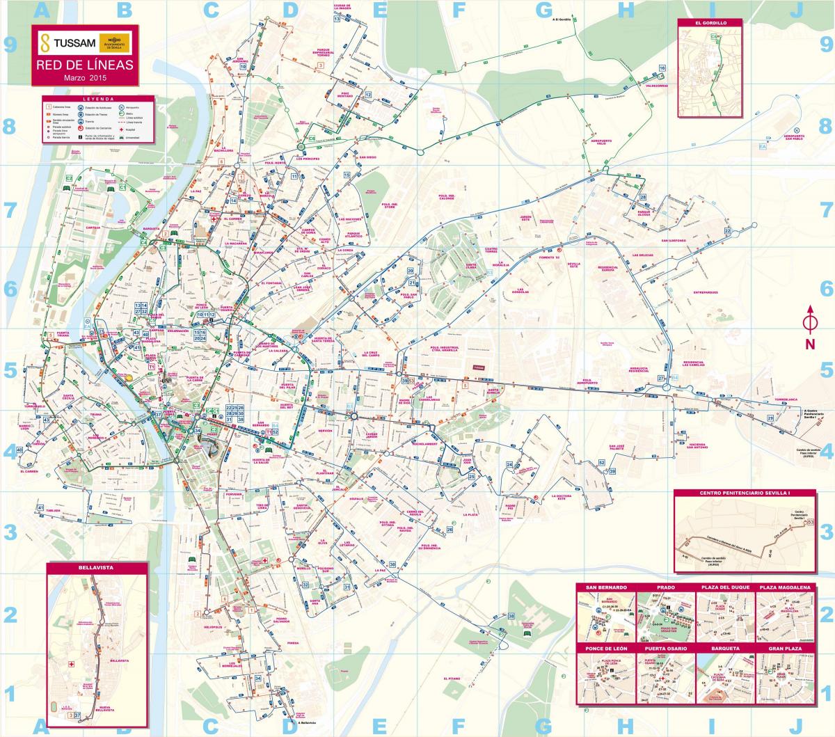
You can find on this page the Seville transport map to print and to download in PDF. The Seville transportation map presents the transports network and transport zones of the transit of Seville in Spain.
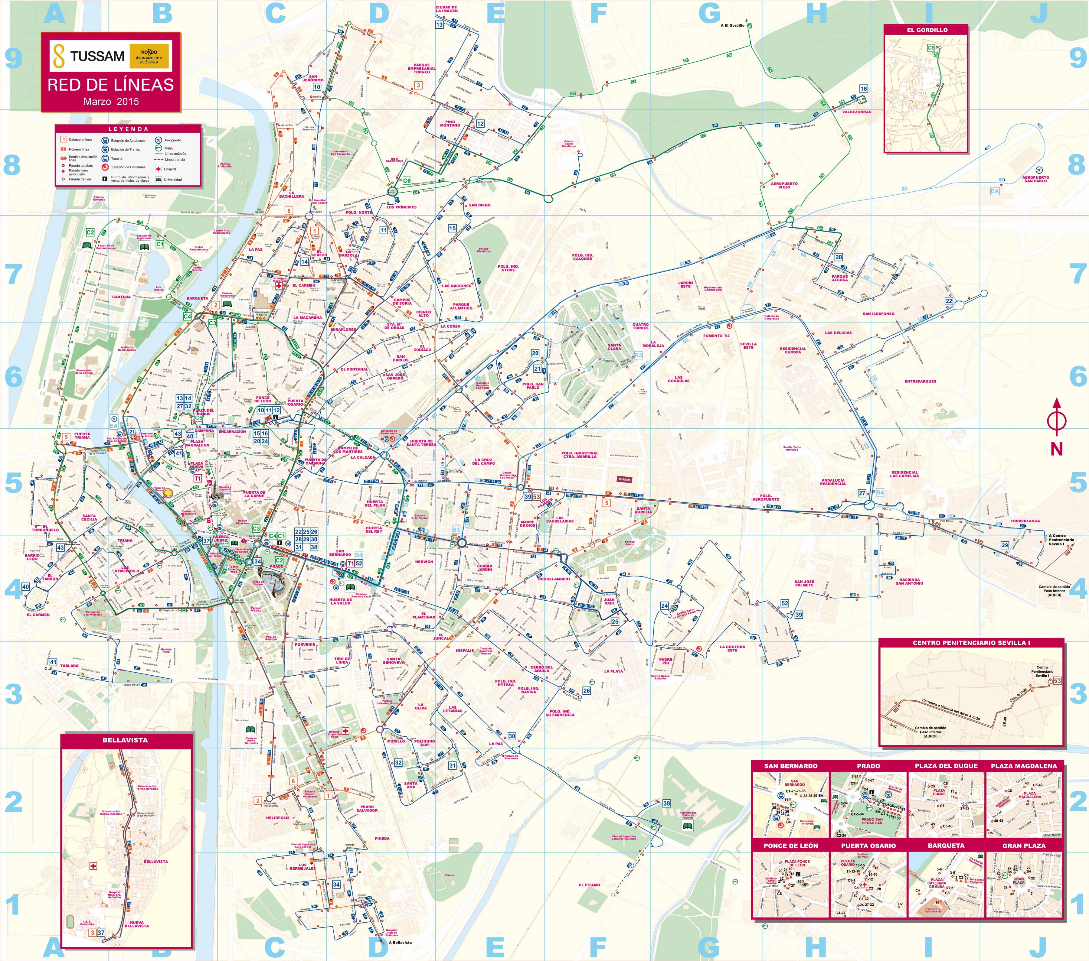
The Seville transport map shows all means of transportation in Seville. This transports map of Seville will allow you to move easily with public transport of Seville in Spain. The Seville transportation map is downloadable in PDF, printable and free.
Seville, the fourth largest urban centre in Spain, was recently voted Lonely Planet number one city to visit in 2018 (see Seville transports map). The award made a point of mentioning Seville impressive network of bicycles and trams, but it neglected to mention that it is actually their ten year anniversary. Seville metro opened just two years later. This makes now an excellent time to look back on Seville public transport network – especially because almost all of it was completed in the middle of the global financial crisis.
Seville has a variety of public transport options to fit the needs of all its citizens and visitors as you can see in Seville transports map. Seville transports network offers a public bicycle lane and bicycle rental system, an urban bus system, a tram line, a metro line, two train stations, and many official taxis.
While a huge chunk of the city of Seville can be seen on foot, the availability of taxis, buses and city bikes throughout Seville means you can save valuable time during your stay here, especially if you are only in town for a quick weekend trip (see Seville transports map). And with so much to see in the south of Spain, the beautiful towns and cities nearby are also well-connected to the Andalusian capital with an efficient public transport, making the logistics of day trips that much easier