

You can find on this page the Seville buses map to print and to download in PDF. The Seville bus system map and the Seville trolley map present the network, stations and lines of the buses and trolley of Seville in Spain.
The Seville bus map shows all the stations and lines of the Seville bus system. This bus map of Seville will allow you to easily plan your routes in the buses of Seville in Spain. The Seville bus system map is downloadable in PDF, printable and free.
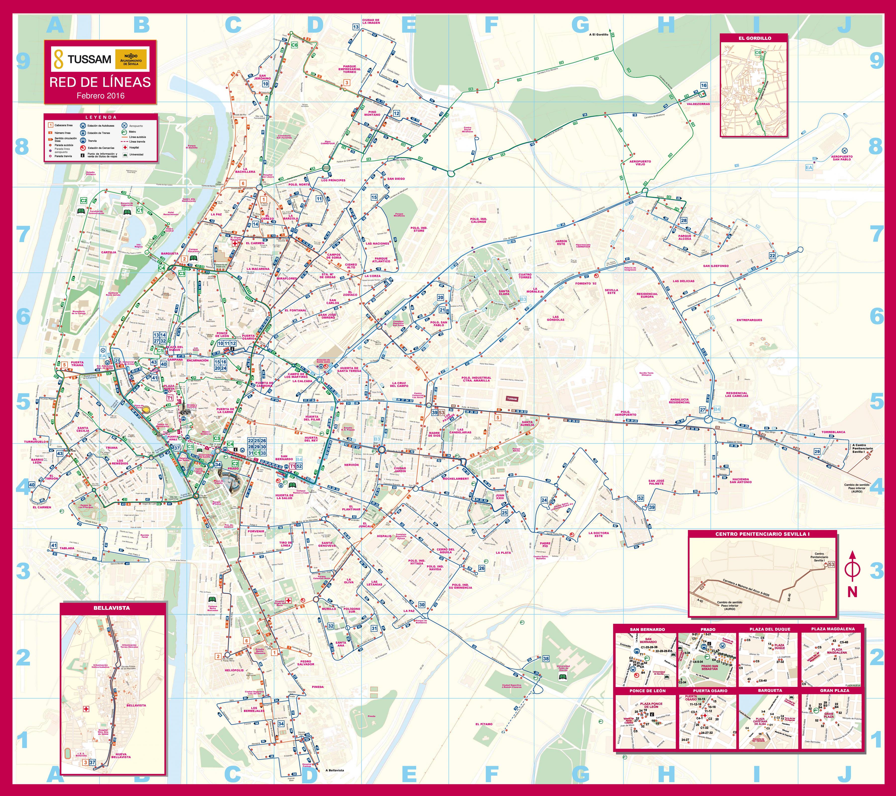
Seville is served by the TUSSAM (Transportes Urbanos de Sevilla) bus network which runs buses throughout the city. Two bus stations serve transport with surrounding areas and other cities as its shown in Seville bus map: Plaza de Armas station, with destinations towards north and west, and Prado de San Sebastián stations, covering routes to south and east.
The circular buses, C3 and C4, follow the ring road around the old city centre of Seville as youcan see in Seville bus map. One small bus takes a circular route inside the centre, the C5. Seville buses run from about 6am to 11.30pm, with night buses leaving from the Prado from 12 midnight to 2am. For more information, see the Tussam website. Tickets cost 1.40 euros per trip, bought onboard.
Seville bus system runs from around 06:00 to 23:30 as its shown in Seville bus map. With several lines in operation, you can navigate your way around by looking at the bus routes on the online plan, or by picking up a map from a tourist office. In addition, several night buses depart from Prado San Sebastián area in central Seville. While many use the Especial Aeropuerto bus to get to and from the airport, the bus also stops in popular areas including the Santa Junta Station and Nervión Plaza shopping mall.